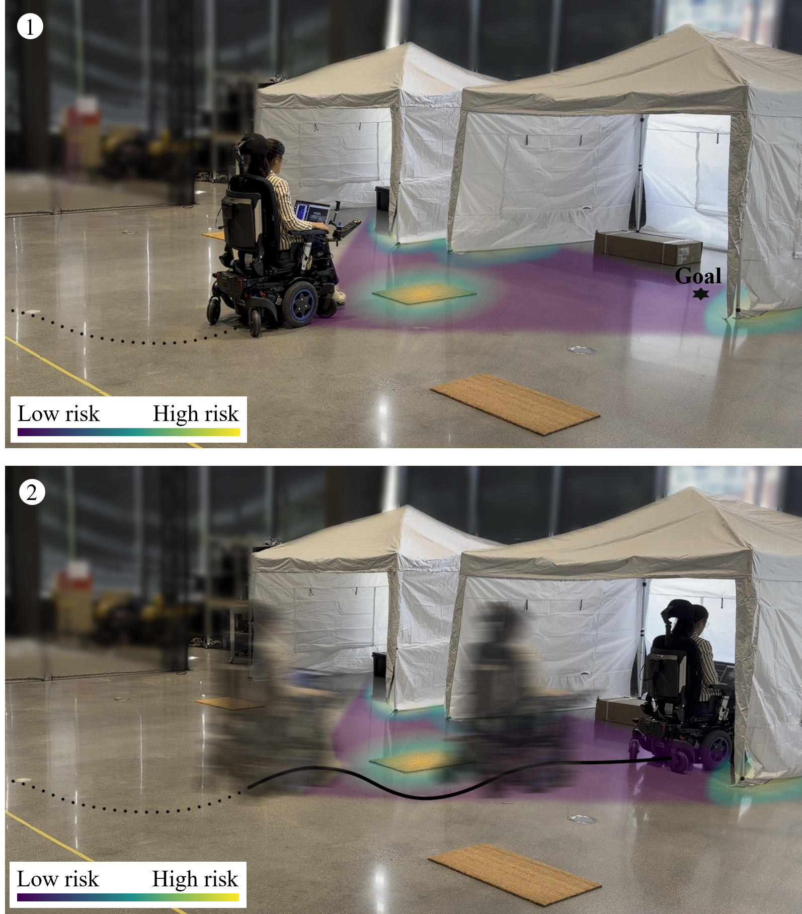
In expeditionary medical facilities, routine patient transport imposes a compounding burden of personal protective equipment consumption, staff diversion, and elevated infection risk that becomes unsustainable under surge conditions. While autonomous wheelchairs could absorb this operational load, the safety-critical nature of patient transit within these highly unstructured and dynamic environments poses complex navigational challenges. To address this, we present a multi-layer risk mapping framework that fuses heterogeneous environmental hazards (terrain slope, obstacles, semantic traversability) into a unified probabilistic cost surface to ensure safe autonomous patient transport. We evaluate the framework in simulation and validate its real-world applicability on a commercial powered-wheelchair platform across three representative mission profiles: intake, intra-facility transfer, and egress. Our results demonstrate that this architecture successfully meets the planning requirements of this previously unaddressed operational regime.
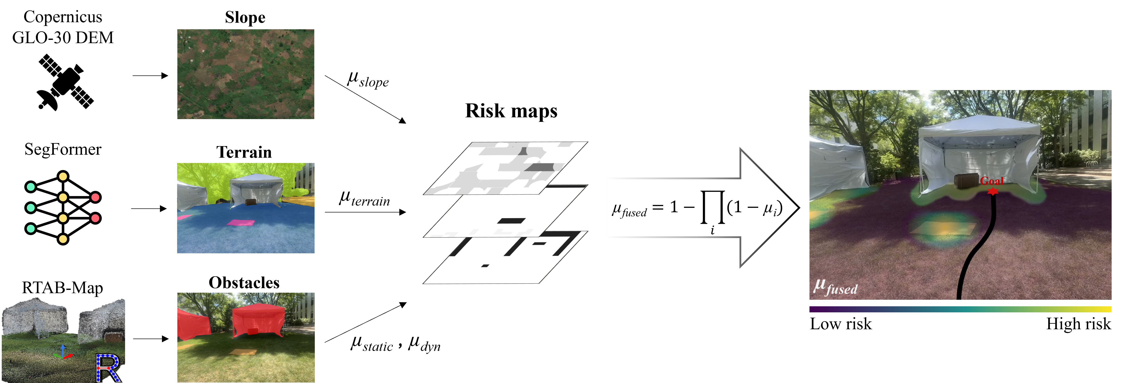
Figure 2. Global elevation data, real-time semantic segmentation, and IMU-visual SLAM are fused via a Noisy-OR model into a unified cost surface driving an MPPI local planner.
Our framework decomposes environmental risk into four complementary layers: terrain slope derived from global elevation data, obstacle proximity from real-time LiDAR and depth sensing, semantic traversability from a learned segmentation model, and localization uncertainty from IMU-visual SLAM. These heterogeneous risk signals are combined through a Noisy-OR probabilistic fusion model, producing a unified cost surface that preserves the independence of individual hazard detectors while capturing their joint effect. The resulting risk map drives a Model Predictive Path Integral (MPPI) local planner for real-time trajectory optimization.
Citation coming soon.